TagRanger®
Mapping Functions
The Track tab on the TagRanger® App is where your interactions with deployed Tags are controlled, with Tag positions overlayed on to a map
The map can be dragged around with one finger and supports the pinch-to-zoom function. Key features of the mapping interface are described below, see also the pages on performing a FIND and LOCATE for further details on the menu functions for these features.

Mapping Icons
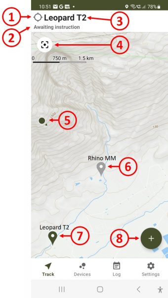
1 - Activity indicator. Spins to indicate a function is in progress. A black dot appears when an action is confirmed and spinning continues.
2 - Description of current operation status
3 - Name of the active Tag
4 - Zoom the map to fit your location and the pin of the active Tag
5 - Your position with an arrow to indicate your heading
6 - Last known position (pin) of the named Tag. Grey indicates this is not the active Tag. If you tap a grey pin it will make that Tag the active Tag
7 - Last known position (pin) of the active Tag. The active Tag pin is dark green.
8 - Menu expansion button

Pin Operations
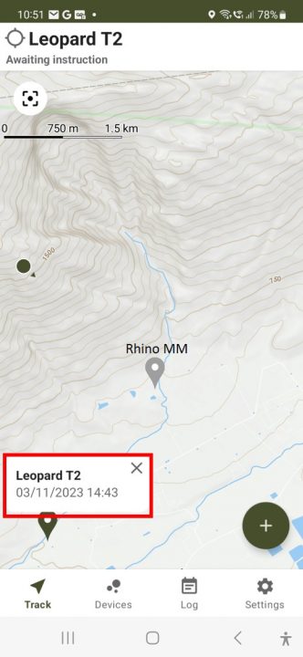
Press and hold any pin to pop up a box indicating the time and date of the location
Change the active Tag by tapping on any grey pin

Download Offline Maps
1 - Move the map to the location where you wish to download the map for offline use.
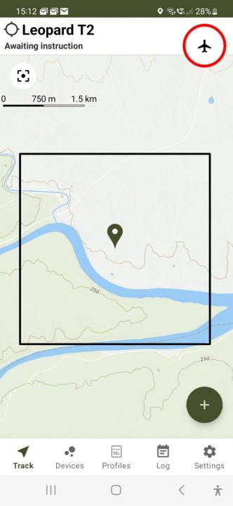
2 - Press and hold the centre of the area you want to download and a black square will appear approximately 3km x 3km in size
3 - Tap the aeroplane icon in the top right of the screen to download the map
You can manage offline map regions and the map tile provider in the Settings page of the App.
